Model evaluation
Forecast versus actual comparisons
The radar that happened, beside what HRRR and RRFS forecast for that same hour when issued 1 to 36 hours earlier. Two real cases from 20–22 September 2026, chosen by the data — the most convective hour in the record and a moderate one — not by hand. Same reprojection and NWS colour table as the app; MRMS is the observed radar.
Compare in placeGrouped by how far out the forecast was made, not by day. Tap Actual, HRRR
or RRFS above an image — the frame stays put, so you can flip between them and watch what moves.
FSS30Placement score within about 30 km, 0–1, at ≥20 dBZ (any
echo) and ≥35 dBZ (avoid). 1.0 is perfect coverage placement.
area ×Forecast area at ≥35 dBZ divided by observed. 1.0× is honest;
1.8× paints nearly twice the weather that fell.
dBZ
20
25
30
35
40
50
60
+1hour
1 hour out
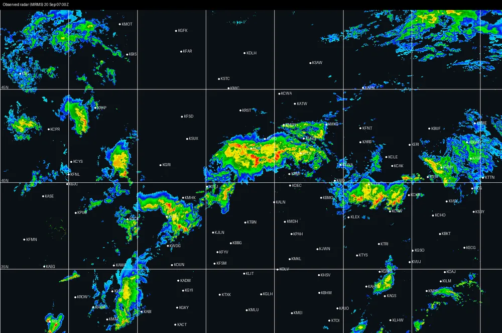
Actual · MRMS Sun 20 Sep 0700Z
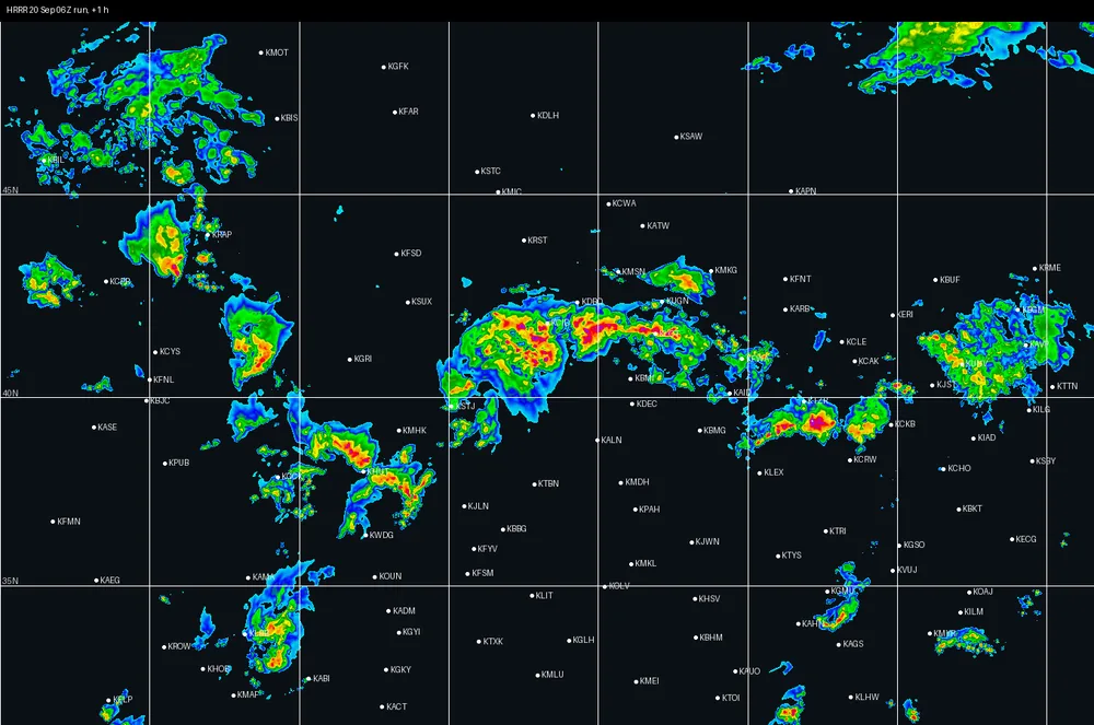
HRRR 20 Sep 06Z · +1 h
FSS30 ≥20 0.88≥35 0.84area ≥35 0.91×
RRFS 20 Sep 06Z · +1 hNo RRFS run reached this far out yet at this valid time.
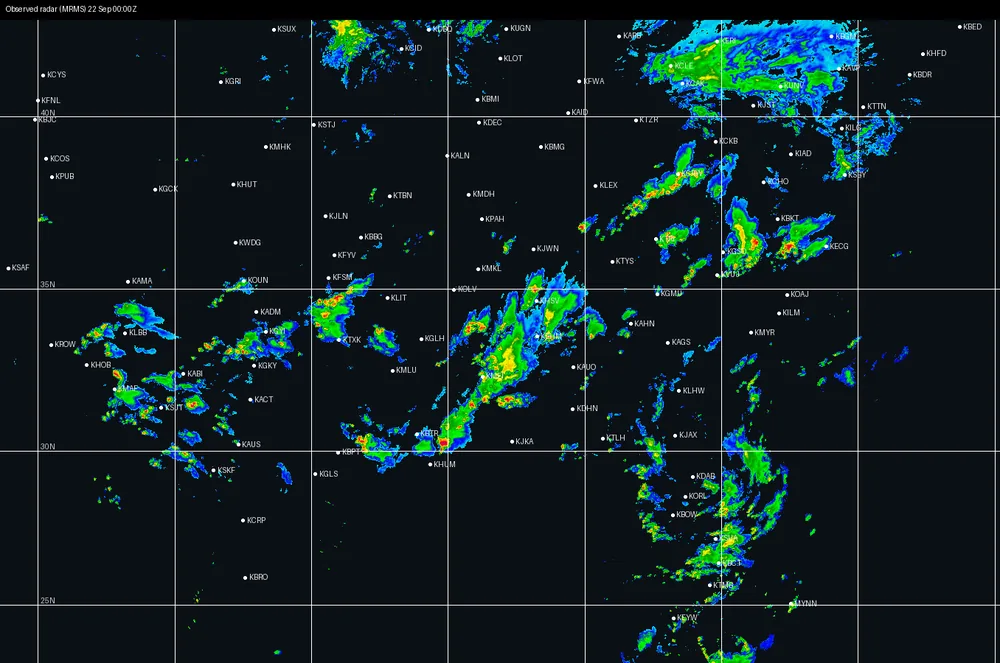
Actual · MRMS Tue 22 Sep 0000Z
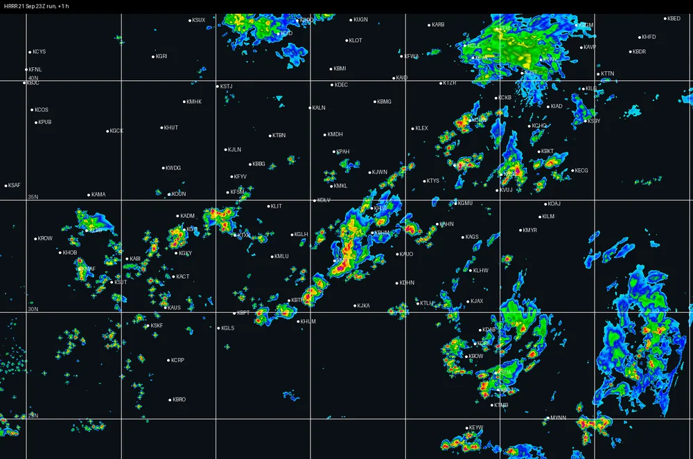
HRRR 21 Sep 23Z · +1 h
FSS30 ≥20 0.88≥35 0.68area ≥35 1.86×
RRFS 21 Sep 23Z · +1 hNo RRFS run reached this far out yet at this valid time.
+3hours
3 hours out
Actual · MRMS Sun 20 Sep 0700Z
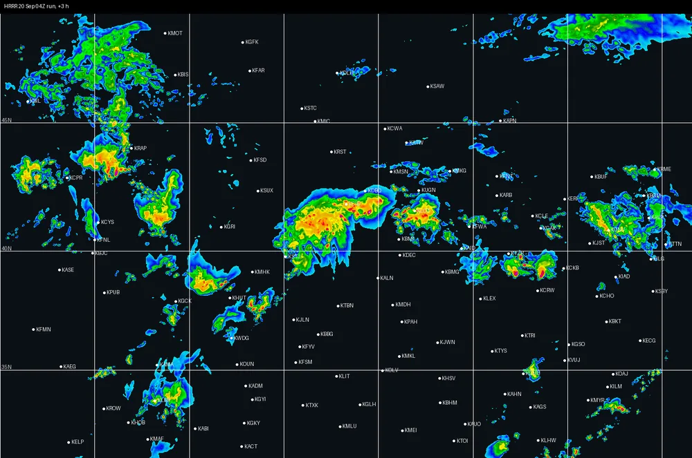
HRRR 20 Sep 04Z · +3 h
FSS30 ≥20 0.77≥35 0.66area ≥35 0.96×
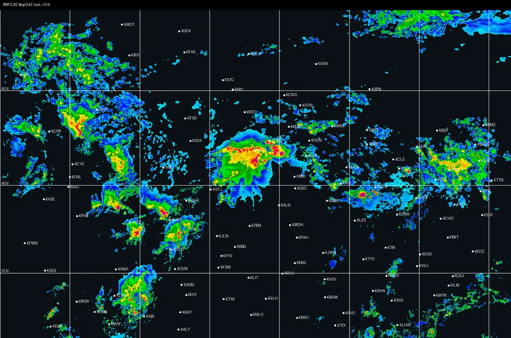
RRFS 20 Sep 04Z · +3 h
FSS30 ≥20 0.76≥35 0.65area ≥35 0.88×
Actual · MRMS Tue 22 Sep 0000Z
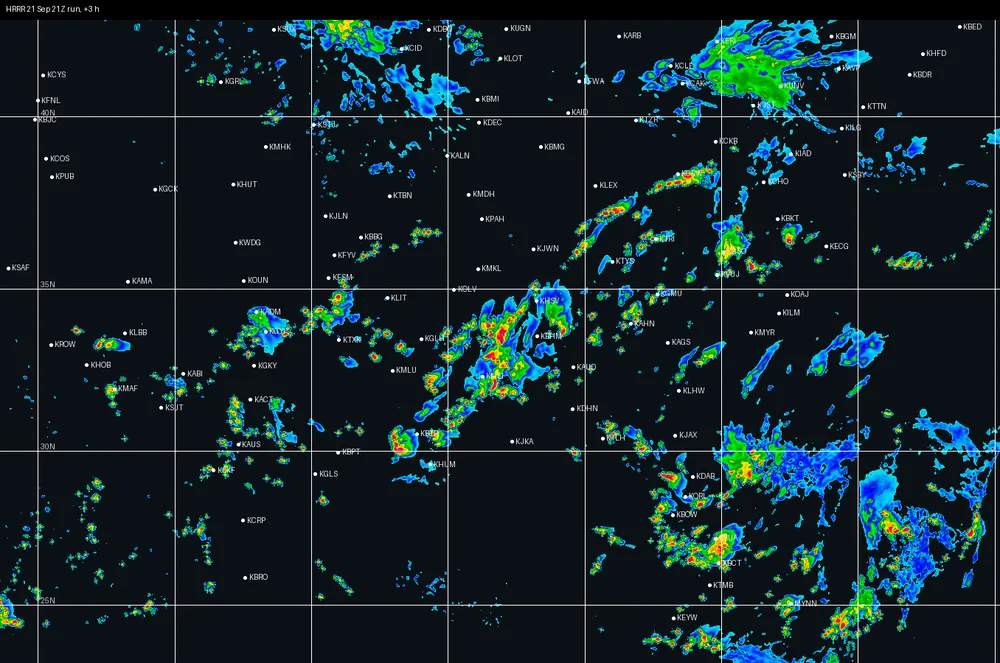
HRRR 21 Sep 21Z · +3 h
FSS30 ≥20 0.80≥35 0.65area ≥35 1.64×
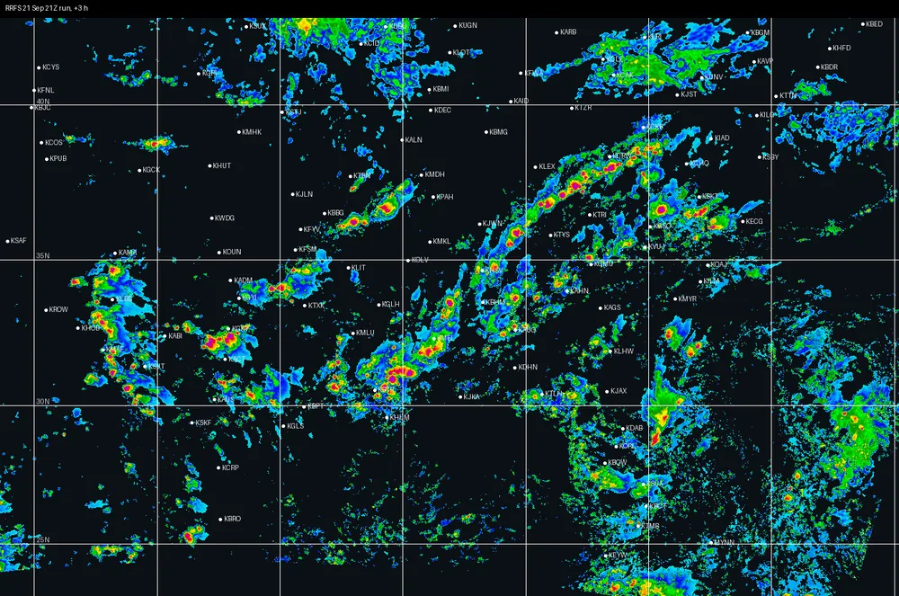
RRFS 21 Sep 21Z · +3 h
FSS30 ≥20 0.65≥35 0.55area ≥35 1.93×
+6hours
6 hours out
Actual · MRMS Sun 20 Sep 0700Z
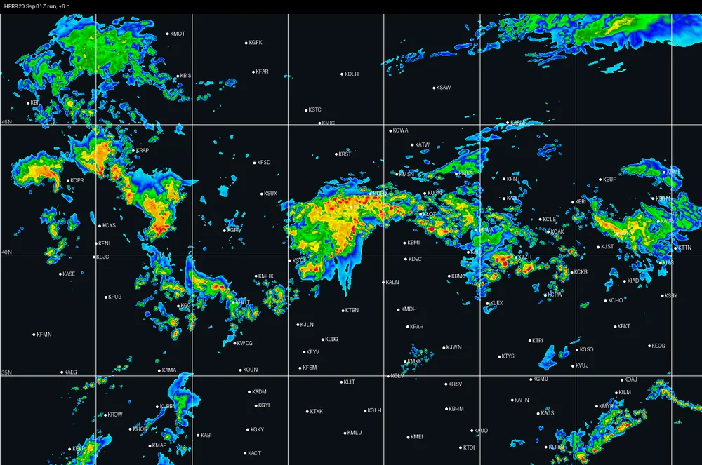
HRRR 20 Sep 01Z · +6 h
FSS30 ≥20 0.78≥35 0.67area ≥35 1.51×
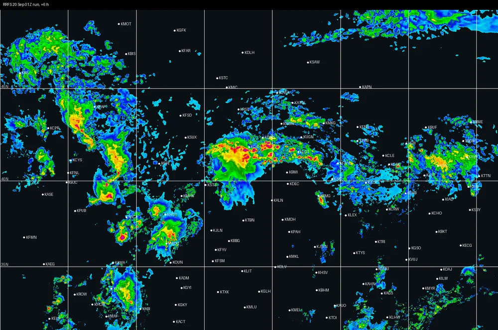
RRFS 20 Sep 01Z · +6 h
FSS30 ≥20 0.74≥35 0.64area ≥35 0.94×
Actual · MRMS Tue 22 Sep 0000Z
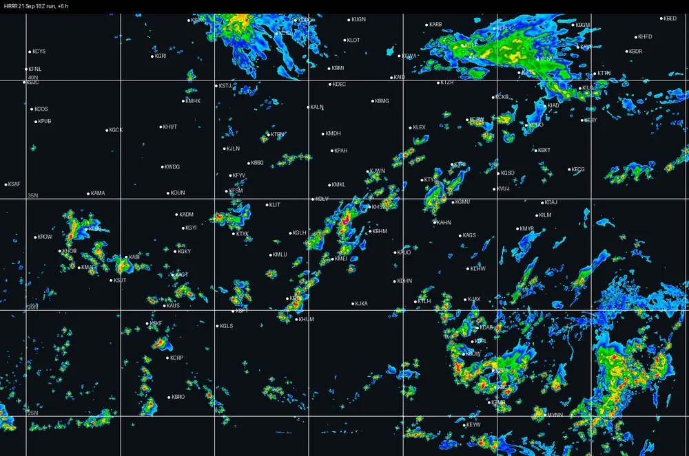
HRRR 21 Sep 18Z · +6 h
FSS30 ≥20 0.71≥35 0.50area ≥35 1.75×
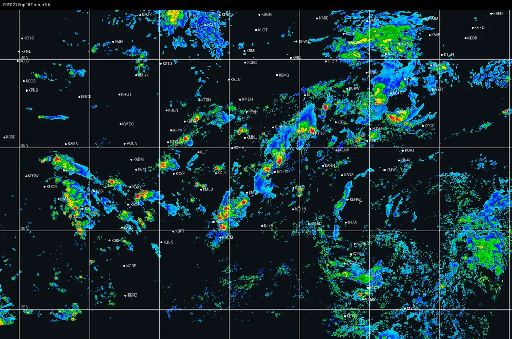
RRFS 21 Sep 18Z · +6 h
FSS30 ≥20 0.67≥35 0.49area ≥35 1.37×
+12hours
12 hours out
Actual · MRMS Sun 20 Sep 0700Z
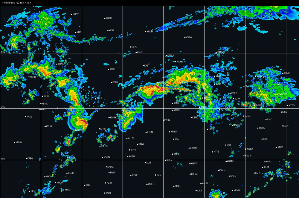
HRRR 19 Sep 19Z · +12 h
FSS30 ≥20 0.71≥35 0.59area ≥35 1.37×
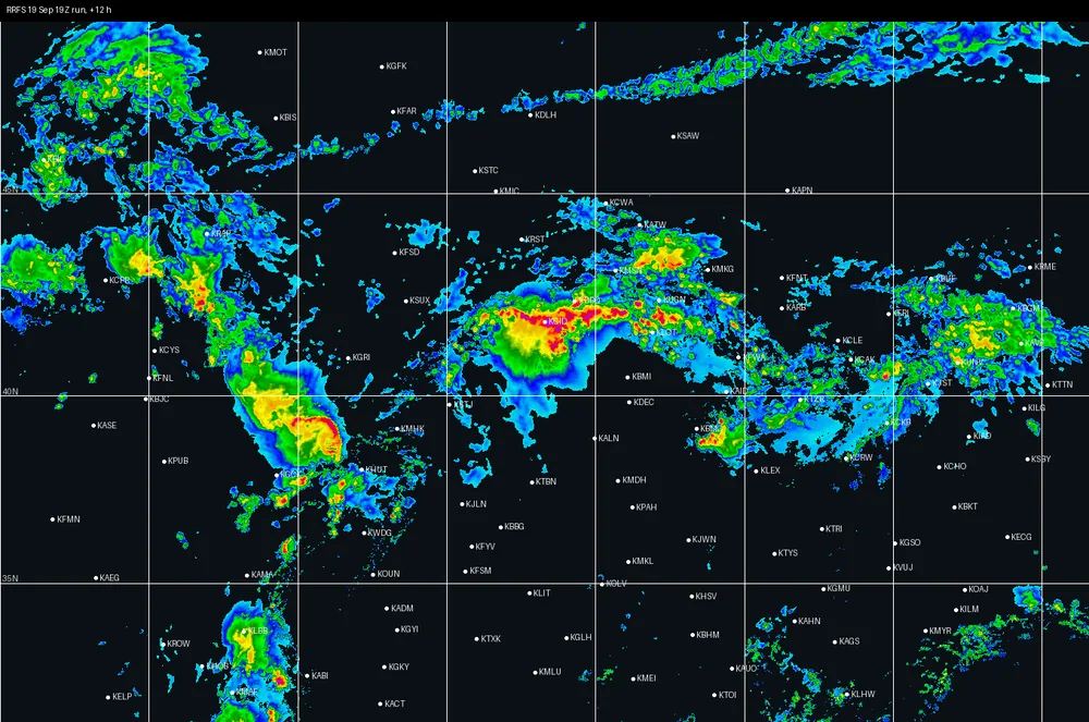
RRFS 19 Sep 19Z · +12 h
FSS30 ≥20 0.70≥35 0.54area ≥35 0.88×
Actual · MRMS Tue 22 Sep 0000Z
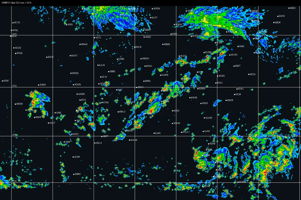
HRRR 21 Sep 12Z · +12 h
FSS30 ≥20 0.64≥35 0.45area ≥35 2.04×
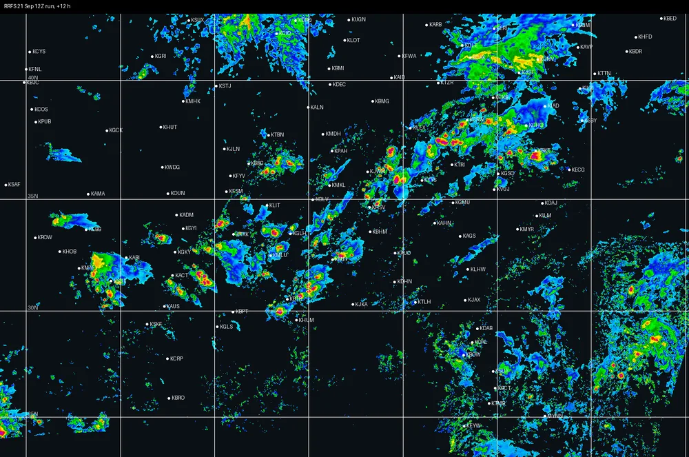
RRFS 21 Sep 12Z · +12 h
FSS30 ≥20 0.61≥35 0.50area ≥35 1.34×
+18hours
18 hours out (one case reached this far)
Actual · MRMS Tue 22 Sep 0000Z
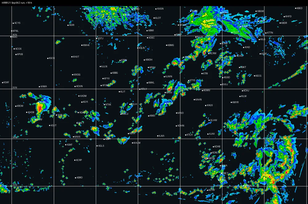
HRRR 21 Sep 06Z · +18 h
FSS30 ≥20 0.60≥35 0.41area ≥35 1.99×
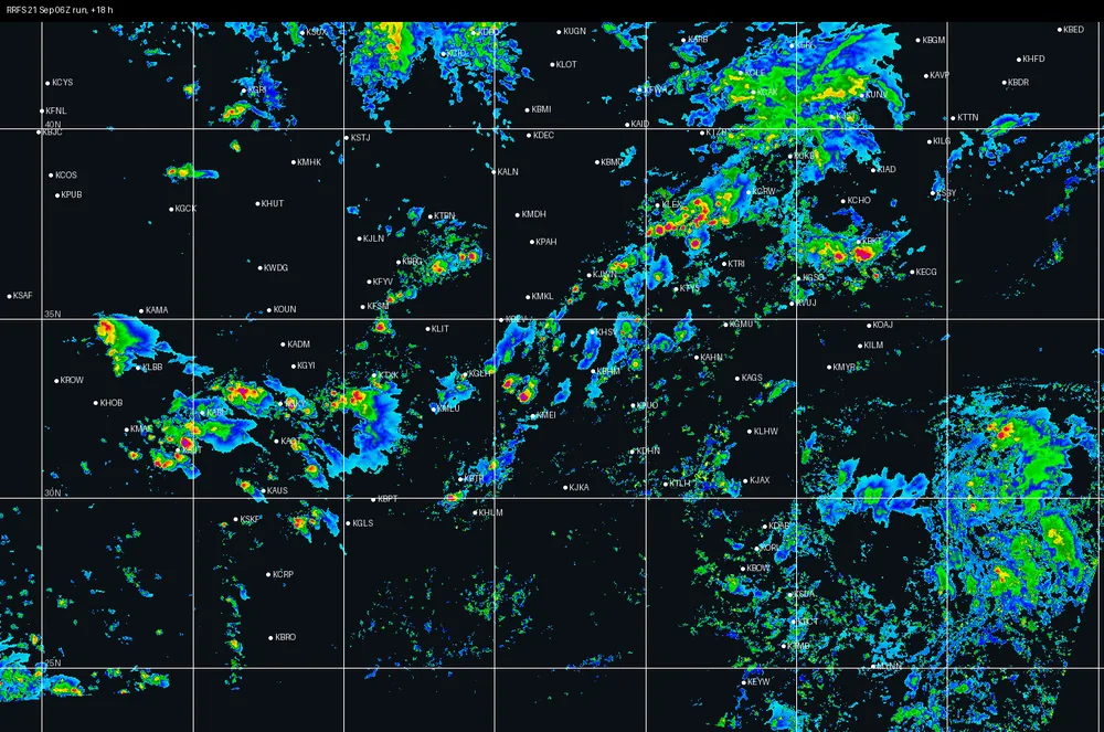
RRFS 21 Sep 06Z · +18 h
FSS30 ≥20 0.65≥35 0.47area ≥35 1.37×
+36hours
36 hours out (one case reached this far)
Actual · MRMS Tue 22 Sep 0000Z
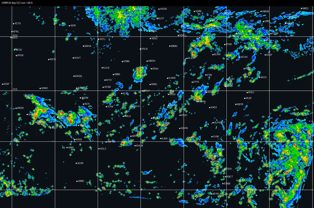
HRRR 20 Sep 12Z · +36 h
FSS30 ≥20 0.59≥35 0.39area ≥35 2.12×
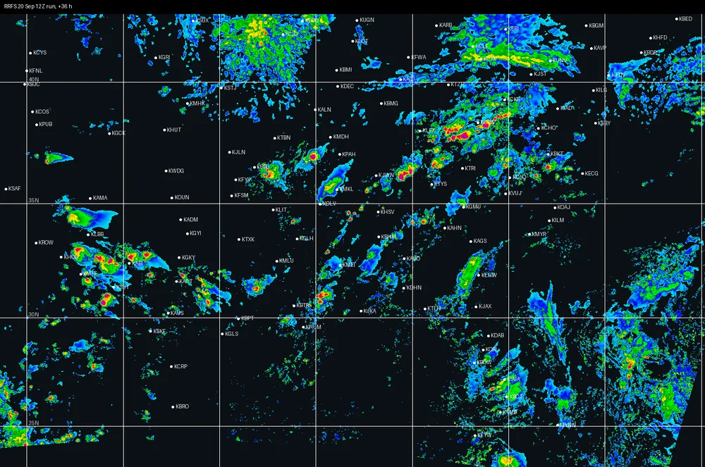
RRFS 20 Sep 12Z · +36 h
FSS30 ≥20 0.60≥35 0.48area ≥35 1.34×
This is a fixed snapshot, captured 22 September 2026 from three days of the pipeline's own
cache. It does not update on its own — we're keeping it as a stable, citable pair of examples
rather than a live feed. Ask us for a current read if
you want one.